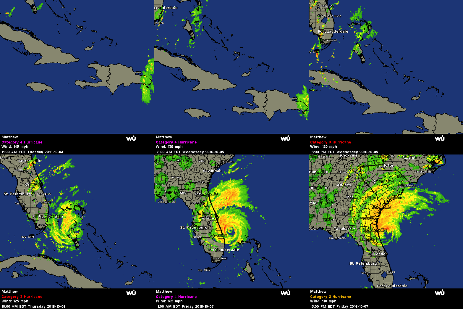
Hurricane Matthew Heads North to Wreak Havoc on Georgia and the Carolinas
After battering the eastern half of Florida for much of Thursday and Friday, Hurricane Matthew will continue its northbound path through Georgia, South Carolina, and reach North Carolina by Sunday. In response to the National Weather Service forecast, following similar declarations in Georgia and South Carolina, President Barack Obama issued a state of emergency in North Carolina.
Monday remains the anticipated return voyage by Florida for Hurricane Matthew. Along its path of destruction, between 8 to 12 inches of rainfall is probable along the eastern seaboard from Florida to North Carolina. Flash flooding is also a likely possibility when 9-foot tall storm surges are coupled with 15-inch rain accumulations inland. Many people following Matthew are unsure either what is meant by ‘storm surge’ or what impact storm surge has on communities impacted by Matthew. The following description of storm surge can be accessed via the National Oceanic and Atmospheric Administration: “Storm surge is an abnormal rise of water generated by a storm, over and above the predicted astronomical tide. Storm surge is caused primarily by the strong winds in a hurricane or tropical storm. In general, storm surge occurs where winds are blowing onshore. The highest surge tends to occur near the ““radius of maximum winds,”” or where the strongest winds of the hurricane occur.”
To summarize it more plainly, storm surges are responsible for the majority of damage inland during hurricane and tropical storms. Matthew’s devastation is still being calculated. However, as of Friday evening, over one million Florida residents were without power and at least four died.
Despite this weather system slowing in pace, local officials remain steadfast in issuing warnings and imposing curfews to protect first responders from undue risk of harm. The reduction in speed led to a reclassification of Matthew as Category 2 (down from Category 4).


